BALTAEROSERVIS was founded in April 1997. Since the very beginning, our core business has been dedicated to airborne mapping. We entered the business using analog equipment:
AFA-TE-100, 200, 350;
TAFA-10, TES-10;
AFA-42-20;
MRB-90, 150
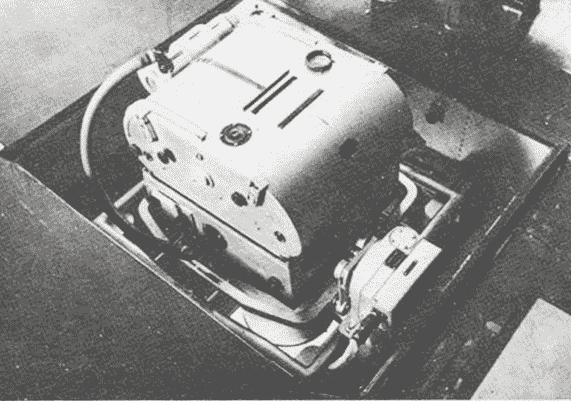
Pic. 1. Analog aerial camera
Aerial survey and data processing were much more complicated and labor-intensive job comparing to nowadays. Just to mention photofinishing including, but is not limited to aerofilm developing, negative drying, contact print etc. However, annually we performed large amount of work in terrain mapping as well as in forestry management. The major work area was northwest Russia. We performed aerial survey using rented aircrafts from AN-2 to TU 134 and necessarily recruited a professional aerial survey navigator due to the absence of active GPS navigation and GPS referencing of aerophotography by then. The total analog aerial survey acquired by BALTAEROSERVIS can be evaluated in over 500 000 square kilometers for forestry management and more than 250 000 square kilometers for terrain mapping.
Over 10 years ago we gradually moved to digital equipment. Started with medium format cameras like Canon, Haselblat we later moved to PhaseOne with 65 Mpix matrix. Then matrix and lenses changed. Nowadays a medium format PhaseOne 645 AF has a 80 Mpix sensor and a set of modern lenses with a varied focal length. Digital survey processing has been permanently improving as well. We started from Talka v3.6 and tested various software, including EnsoMozaic by Stora-Enso. The hardware, software, procedure upgrading has never stopped. Today our company uses modern hardware and software described in the relevant Website sections. It should be noticed that the company uses, alongside with the cutting-edge equipment, two owned aircrafts. This allows us to perform aerial survey more flexibly and effectively.