- accuracy complying with the requirements of the current standards (technical regulations and specifications);
- any possible spectral-response characteristic: black-and-white, colour, conditional colour;
- high photometric quality;
- image tone adjustment in the entire ortophoto;
- no visible stitching in ortotransformed images.
For the past several years our company produced:
- Digital ortophotos of major population center in Russia with GSD 10 cm;
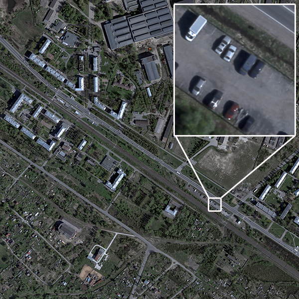
Pic. 1. Sample ortophoto of built-up area
- Digital ortophotos in the Republic of Karelia, the Leningrad Region, the Pskov Region, the Novgorod Region, the Ivanovo Region with GSD 10 cm;
- Digital ortophotos of aerial and space survey of vast areas of northwest Russia, including forestry management purposed survey with GSD 25 cm.

Pic. 2. Sample forestry management purposed ortophoto in conditional colours.
We process aerial images and create digital photomaps and ortophotos using up-to-date software designed by leading Russian and foreign vendors, such as LightSpeed 3.7 (VisionMap, Israel), Geomatica (Geoinformatika public company), Talka 4.02 (Talka group of companies), Photomod 5 (Rakurs company) etc.